Denver’s Plan to Turn Its Lifeless Parking Crater Into a Walkable, Bikeable Neighborhood
There's a sparkling long-term vision to replace parking lots with a place conducive to street life.

It’s March, which means Denver’s year-long reign at the pinnacle of parking lot infamy will soon come to an end. What a difference a year makes.
After the city won Streetsblog’s 2017 Parking Madness championship for the 125-or-so acres of surface lots surrounding Elitch Gardens, Pepsi Center, Mile High Stadium, the aquarium, and Auraria Campus, the amusement park owners said they would redevelop 18 acres of asphalt. Seasonal car storage would give way to homes, businesses, and parks.
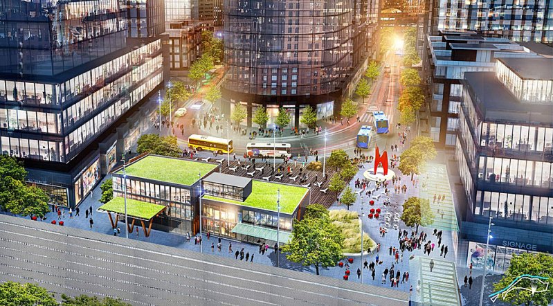
Revesco Properties, which owns Elitch Gardens, recently went public with its plan for the parcel, launching a website replete with a six-minute marketing video showing a walkable, mixed-use neighborhood.
It looks like a huge step forward for human-scaled development in an area that’s currently hard to traverse without a car. The problem is, there’s no way to build it under current zoning rules, which require large amounts of parking.
Enter Community Planning and Development’s “Central Platte Valley-Auraria District” plan, which is meant to shape streets and buildings on the Revesco parcel and about 40 more acres in the area. The plan will inform zoning changes that set the stage for development on these 60 acres, and a draft is now available online.
Overall, the recommendations are conducive to a human-scaled neighborhood where it’s easy to get around by walking, biking, or transit. For example, CPD recommends that streets be no wider than two through lanes, and the block sizes would be “intimate” — no larger than a standard downtown block — to allow for convenient walking trips.
High-quality sidewalks and bike lanes would be standard. Some blocks in the new street grid would be “shared streets” (also known as “woonerfs”) where cars are allowed but pedestrians use the whole width of the street.
The two light rail stations in the area would be complemented by “mobility hubs” with ample bike parking, real-time transit info, bus shelters, bike-share, and car-share.

Crucially, the city recommends capping the number of parking spots developers can build, which will be essential to curbing traffic and creating a good pedestrian environment. The plan also calls for the zoning code to allow taller buildings (the height limit here is currently 200 feet), and a development fee that would help fund subsidized housing in the neighborhood.
Some important details aren’t spelled out in the draft plan. Sidewalks will be “large,” but how many feet wide will they be? How much parking will be allowed? It would be good to get those pieces down in writing for a guiding document such as this.
If you have ideas on those specifics or any other aspect of the amendment, take the city’s Central Platte Valley-Auraria survey.


