Food for Thought: Denver’s 175 Drive-Throughs Overlap With Denver’s Deadliest Streets
Here’s something to sink your teeth into: Denver has more than 175 drive-throughs and most are located on the city’s deadliest streets to travel on.
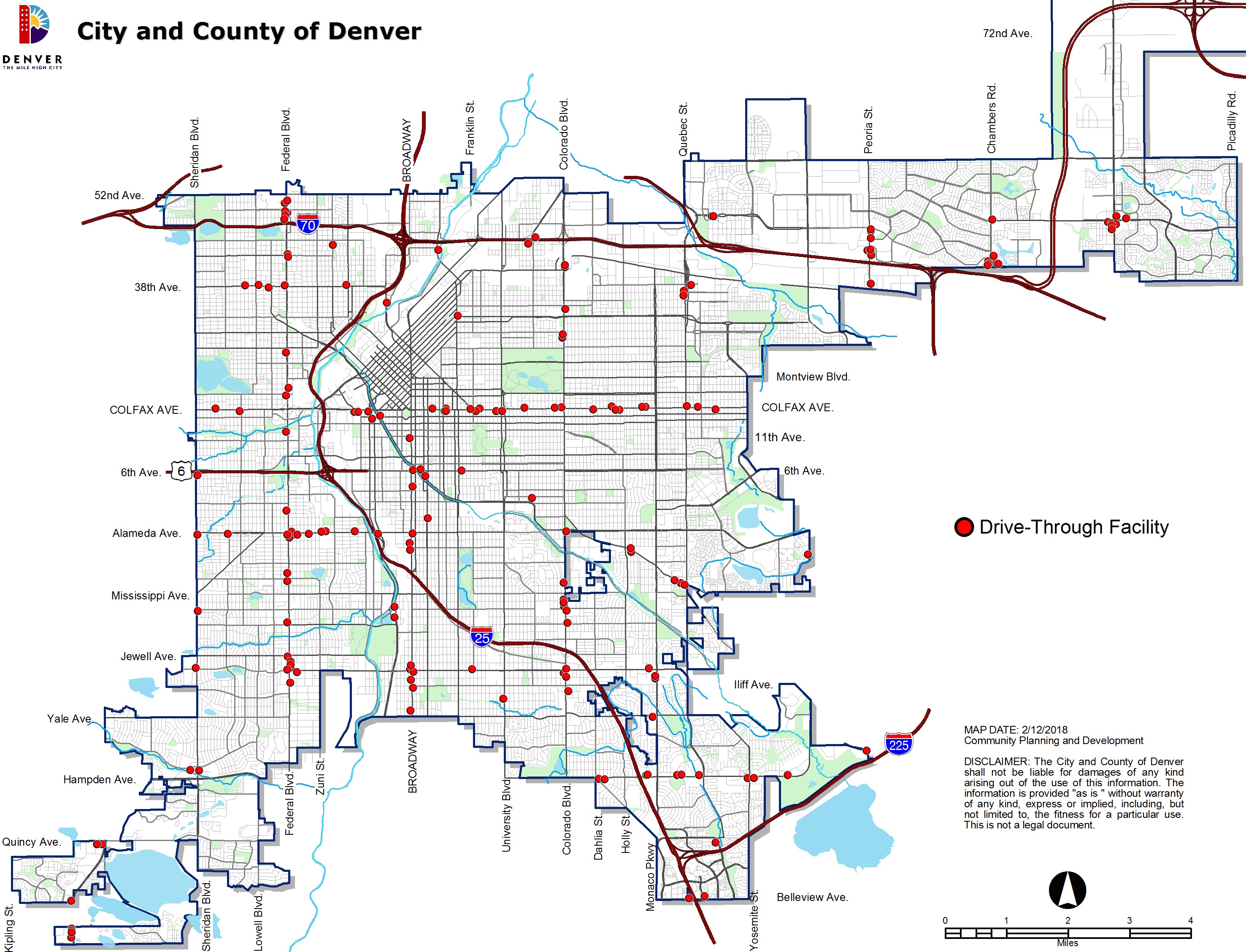
Check out the overlap between this map of Denver drive-throughs (it doesn’t include banks)…
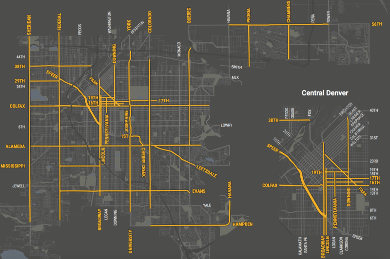
…and the city’s “high injury network” — the streets where half of Denver traffic deaths occur despite accounting for just 5 percent of its roadway mileage:
Like Colfax Avenue, Federal Boulevard, Broadway, and other deadly Denver streets, drive-throughs are built around convenient motoring to the exclusion of other modes of transportation.
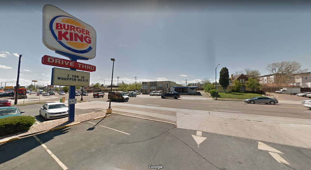
They’re terrible for pedestrians because they chop up sidewalks. One drive-throughs typically has two curb cuts — an entrance and an exit. Those are two points along the sidewalk where people on foot have to worry about dodging drivers turning off or onto high-speed streets.
Meanwhile, every drive-throughs is typically attached to a surface parking lot that degrades the pedestrian environment and spreads destinations farther apart, so there are fewer places you can reach on foot.
It’s a vicious cycle where the land use that has developed around car-centric streets makes it even more difficult to get around by walking and transit.
And yet, the potential for a different model of transportation and development is hiding in plain sight. The same streets where drive-throughs dominate are the busiest transit corridors in the city, which also makes them magnets for pedestrians.
Denver needs to play to its strengths and prioritize walking and transit on these major streets — the East Colfax bus rapid transit project is a start. But that’s not all. As the Hancock administration looks to overhaul its land use and transportation plan, Blueprint Denver, we also need to adjust land use rules to foster walkable development instead of drive-throughs and parking lots.
Hat tip to Eric McClelland for digging up the drive-through data.
Streetsblog has migrated to a new comment system. New commenters can register directly in the comments section of any article. Returning commenters: your previous comments and display name have been preserved, but you'll need to reclaim your account by clicking "Forgot your password?" on the sign-in form, entering your email, and following the verification link to set a new password — this is required because passwords could not be carried over during the migration. For questions, contact tips@streetsblog.org.


