It’s Official: Shoddy Streets Make Walking in Westwood a Hazardous Mess
Livable streets advocates in Westwood, one of Denver’s worst areas for walking and biking, are taking action as the city develops a new plan for their neighborhood.
Westwood Unidos, a neighborhood organization, and PlaceMatters, a think tank for city planning, performed a “sidewalk audit” on Saturday. Residents and volunteers walked the southwest Denver neighborhood, took pictures, and recorded their findings.
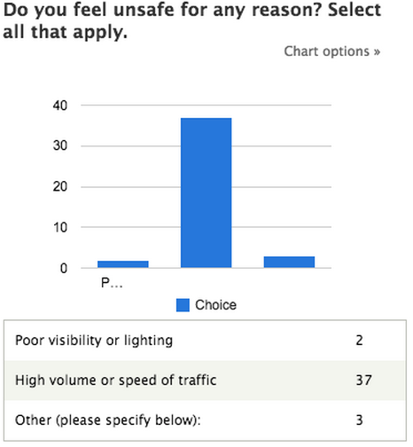
Westwood residents cited traffic speed and volume as the top factor that makes their local streets feel dangerous.
The conclusion? The sidewalks are thin, the drivers are fast, and the connections are poor for Westwood residents hoping to walk and bike safely through their neighborhood.
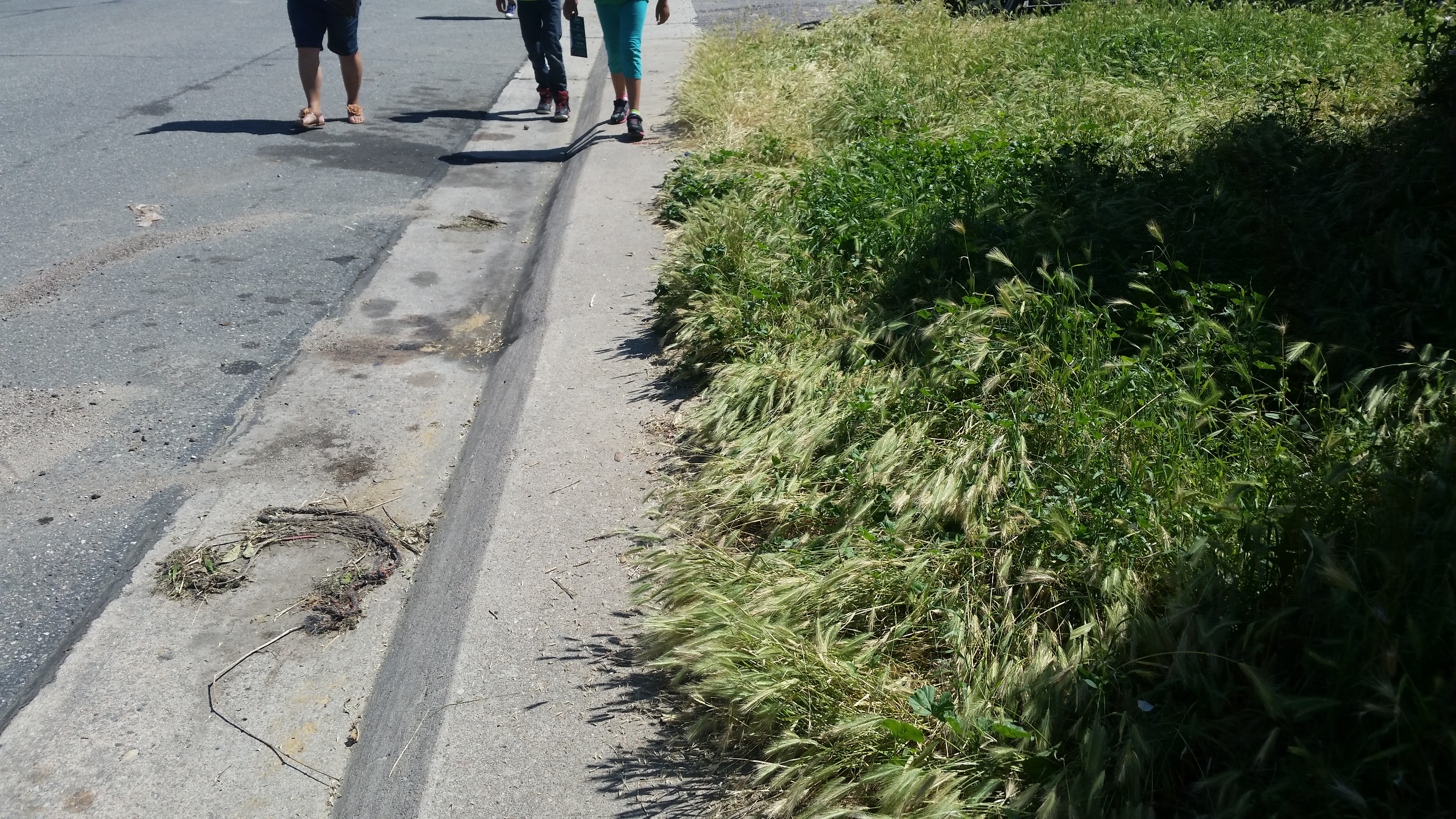
“The sidewalks are really narrow. You can’t fit two people side by side on the sidewalk,” said Westwood Unidos community organizer Maricruz Herrera through an interpreter. “The more transitive streets have wider sidewalks, but the cars go so fast that it’s really scary for people to walk.”
Alameda Avenue, Morrison Road, and Federal Boulevard are especially intimidating, Herrera said. On neighborhood streets, tiny sidewalks force people to walk in the road.
Advocates will share their findings online and with Denver’s Community Planning and Development Department to help prioritize walkability as planners reshape the neighborhood.
“We want to make sure that those needs are actually met for the people that walk in the community,” said Kayla Gilbert, a program manager for PlaceMatters. “There are some places that really aren’t safe so we want to make sure we’re advocating for pedestrian improvements.”
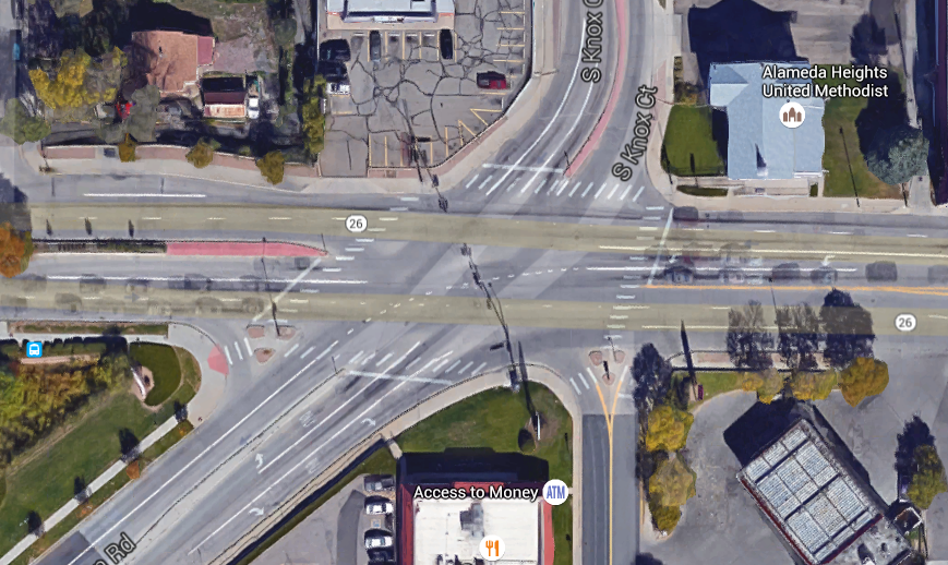
Intersections are a problem, too. Morrison Road is diagonal, creating confusing, wide intersections, Gilbert said, like at Morrison and Alameda, where pedestrians have to cross seven lanes of traffic.
Massive amounts of traffic data inform decisions about the driving environment, and it’s time the pedestrian environment got the same treatment, said Jill Locantore of WalkDenver. “What gets measured gets done,” she said.
Saturday’s audit shines some light on where and why Westwood’s streets are so dangerous, but it won’t be the last word. WalkDenver will do a comprehensive analysis this fall using WalkScope, a (very cool) tool that uses crowdsourcing to map the gaps in Denver’s pedestrian network. In the meantime, the city should hear Westwood advocates loud and clear.
“Ideally the city will learn that we really want to make these changes because it would be so important for our community,” Herrera said.
Streetsblog has migrated to a new comment system. New commenters can register directly in the comments section of any article. Returning commenters: your previous comments and display name have been preserved, but you'll need to reclaim your account by clicking "Forgot your password?" on the sign-in form, entering your email, and following the verification link to set a new password — this is required because passwords could not be carried over during the migration. For questions, contact tips@streetsblog.org.


