Will Hancock Follow Through on Upgrades to the Speer-Leetsdale Corridor?
There’s new evidence that Denver Public Works is slowly breaking down the bulwark of car-first planning, but that won’t guarantee better transit, walking, and biking anytime soon along Speer Boulevard and Leetsdale Drive.
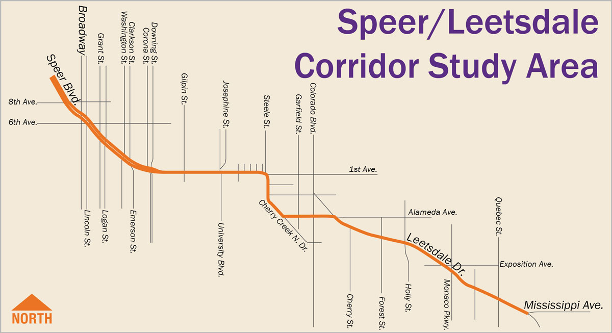
The department’s planners and consultants are working on a new transportation scheme for the Speer-Leetsdale corridor, branded “Go Speer-Leetsdale,” that puts transit, walking, and biking first. In the process, more and better options to travel sans car should alleviate traffic caused by personal vehicles.
The good news? People who work and live in the area not only agree with the changes, they applaud them. A “stakeholders group” has been working with transportation planners since May to push good ideas forward and cross bad ideas off the list — like making segments of Leetsdale, 1st Avenue, Alameda Avenue, and Steele Street one-way. Planners and residents have also nixed widening Leetsdale and Speer Boulevard by one lane in each direction, as well as widening Alameda, even though the city’s 2008 Strategic Transportation Plan calls for the latter. Hallelujah!
Here’s what the corridor needs, and what’s being considered.
Transit
Right now 13 unreliable bus lines slog through the streets in the corridor, averaging speeds between 10 and 17 mph on a 40 mph street because they mix with general traffic, according to the study. Buses can take 40 minutes to traverse the six-mile corridor in the evening and 30 minutes in the morning. Planners are considering the following fixes to make transit a community asset instead of checkbox:
- Converting one general traffic lane in each direction into transit-only lanes.
- Converting traffic lanes into “managed bus lanes,” meaning the buses might share the lanes with toll-paying drivers, high-occupancy vehicles, or drivers with hybrid and fully electric cars.
- Contraflow (aka reversible) bus lanes on segments with the worst delays. These bus-only lanes would operate inbound during the morning rush and outbound in the evening, adding capacity in one direction by temporarily taking a lane from the other.
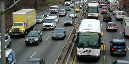
An example of a contraflow bus lane. Image: NACTO - Transit signal priority and/or “queue jumps” at intersections that stop general traffic and allow buses to keep moving.
- More frequent buses and/or new bus routes — perhaps neighborhood circulators or smaller shuttles that operate between “activity centers.”
- 16 improved/new bus stops.
Walking and Biking
Between 2012 and 2014, drivers in the study area collided with people walking 22 times and people biking 25 times, according to the study. Walking and biking routes are often disconnected, too. To make the area safer and more convenient for people, planners are considering the following:
- Fix 29 “substandard” intersections, “protecting and increasing comfort” for wheelchair users, pedestrians, and bicyclists. Fixes could include rapidly flashing beacons and high-intensity activated crosswalk (HAWK) signals that alert drivers to yield to pedestrians.
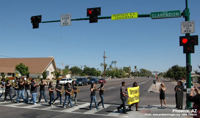
A HAWK signal in Phoenix. Image: NACTO - A raised bike lane along Leetsdale that’s level with, but distinct from, the sidewalk.
- Widening the Cherry Creek Trail along 1st Avenue between Downing and University (adjacent to the street) where people biking and walking currently have to struggle for space alongside speeding traffic.
- A bike-ped bridge connecting Alameda on either side of Cherry Creek Drive.
- Redesign 1st Avenue between University and Steele to include bike-ped routes to the Cherry Creek Shopping District.
The sobering news? These changes are only conceptual. Planners are charged with making sure they’re technically feasible — they are — but that doesn’t mean the Hancock administration will fund and implement them. They could be several years away.
Funding would likely come from the city’s annual capital improvement budget or a municipal bond, if the city decided to go after one down the road, said Jane Boand, a senior planner with Public Works, at last week’s stakeholder meeting.
“So what we’re trying to do with this study is identify the parts and pieces that would make a good entire project to move forward as a package for funding,” she said. “We do have money, it’s just how is it prioritized… if we’re demonstrating some pretty strong mobility needs for this corridor, I’m pretty positive that something is gonna move forward.”
Streetsblog has migrated to a new comment system. New commenters can register directly in the comments section of any article. Returning commenters: your previous comments and display name have been preserved, but you'll need to reclaim your account by clicking "Forgot your password?" on the sign-in form, entering your email, and following the verification link to set a new password — this is required because passwords could not be carried over during the migration. For questions, contact tips@streetsblog.org.


