CU Denver Urban Planning Students Fill in Blanks on Denver’s Walkability
University of Colorado professor Ken Schroeppel is teaching his graduate students how to become urban planners. That means teaching them the tenets of walkability — how to identify gaps in the city’s walking network and how to reorient streets to prioritize pedestrians.
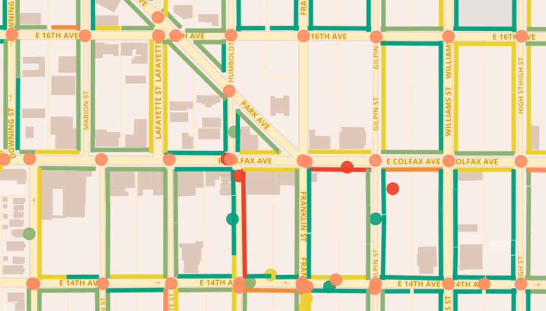
So Schroeppel, who runs DenverUrbanism on the side, gave his students a pretty cool assignment that could have real-world implications. He gave them a real client, WalkDenver, and for six months the students studied East Colfax and its surrounding neighborhoods from Broadway to Colorado Boulevard. They interviewed people, collected demographic information, catalogued the built environment, and rated intersections and sidewalks. Jeff Speck’s “Walkable City” was the accompanying text.
Students presented their condensed findings to WalkDenver last week. So what did they find?
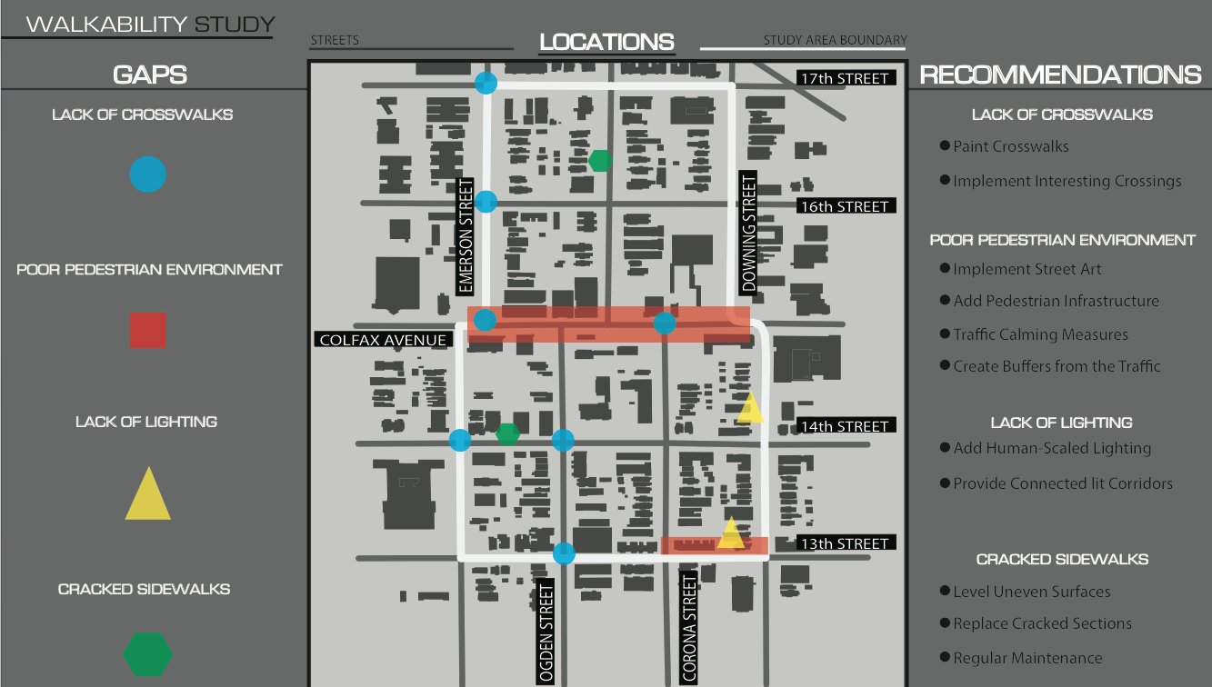
Unsurprisingly, the intersections along Colfax itself are in bad shape, though surrounding streets fared better. Students observed pedestrians play Frogger between speedy, two-way traffic with no refuge except a center turn lane. “People were just accepting that this was a part of their life,” said Megan Yonke, who studied Colfax from Monroe to Colorado.
The future planners suggested solutions, often through engineering.
“If you’re trying to create this culture of walkability, then you sort of need to re-think what the priority is,” said Rodolfo Rodriguez, who studied the same area. “By warning the pedestrian to be careful you’re showing that the car is the priority and that you need to be careful for the car — versus providing a safe environment [for people] and showing the car that you can actually do more damage if you don’t pay attention.”
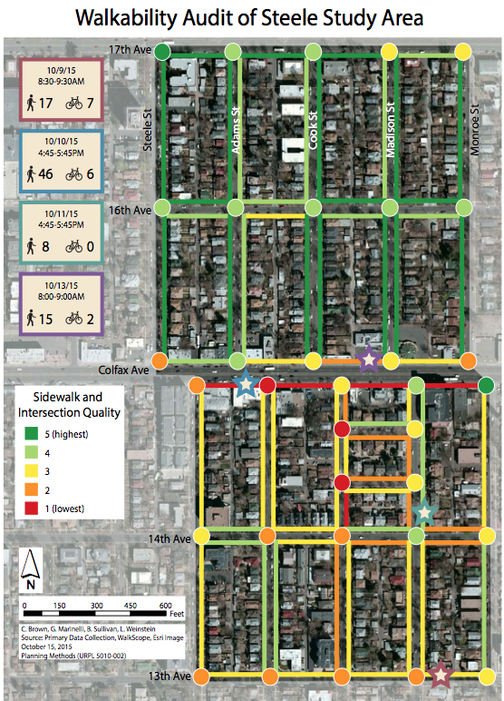
The data has real-life significance. The Department of Public Works doesn’t have a full grasp on which streets and neighborhoods are least walkable, because it has never fully mapped them. Students are filling in those gaps using WalkScope, the crowd-sourcing app that allows anyone to rate Denver’s sidewalks and intersections.
Last year Schroeppel’s class did the same project on West Colfax. They identified gaps and dangers for people walking, eventually informing the Reimagine West Colfax demo. That demo tested out wider sidewalks, bulbouts, enhanced crosswalks with pedestrian-activated signals, and a median refuge with trees. The city is working with business owners on realizing some of those improvements, says Jill Locantore, policy director at WalkDenver.
“More generally, the data helps us to understand the factors that contribute to a safe and inviting pedestrian environment, and demonstrates the need for greater investment in pedestrian infrastructure throughout the city,” Locantore says. “For that reason, the data will be extremely useful for Public Works as they develop the Denver Moves Trails and Pedestrians plan in 2016.”
Streetsblog has migrated to a new comment system. New commenters can register directly in the comments section of any article. Returning commenters: your previous comments and display name have been preserved, but you'll need to reclaim your account by clicking "Forgot your password?" on the sign-in form, entering your email, and following the verification link to set a new password — this is required because passwords could not be carried over during the migration. For questions, contact tips@streetsblog.org.


