Bright Spot in National Western Plan: New Bike/Walk Routes
When voters approved financing for the National Western Center project last week, they gave Mayor Michael Hancock’s administration the go-ahead to create a new neighborhood in northeast Denver. The investment in a long-neglected part of the city is overdue, according to its supporters, who say the National Western Center will anchor economic development there. At the same time, state officials have questioned whether the $1.1 billion project is necessary, and residents worry about gentrification.
As Streetsblog reported last week, a major reason the project costs so much is the huge amount of parking construction it calls for. That’s a shame, because all that parking will create traffic that overwhelms the very real benefits in the plan, which promises to fill a hole in Denver’s street network and connect Globeville, Elyria Swansea, and RiNo to one another.
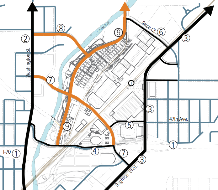
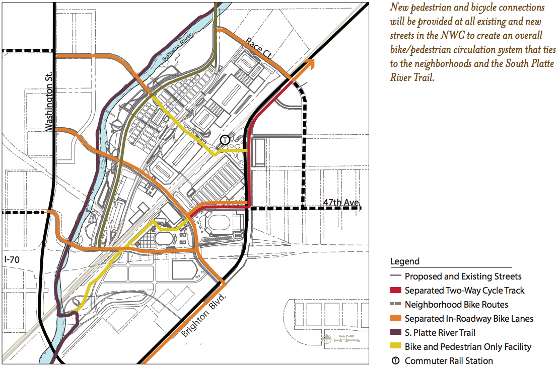
Other parts of the blueprint prioritize biking and walking on three brand new streets. These streets will create a better network and connect people with RTD’s N Line, scheduled to open in 2018. While the biking and walking improvements will make a difference, they will also be undercut by very wide travel lanes for motor vehicles, which will encourage dangerous speeds. Here’s what these three streets will look like:
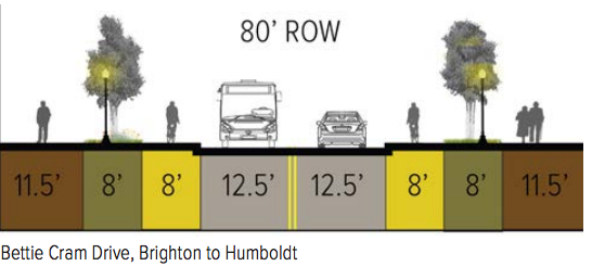
Bettie Cram Drive: A two-lane “main street” that crosses the Platte River to connect Washington Street to Brighton Boulevard. It will have a raised bike lane on each side, and roomy sidewalks with buffers that separate pedestrians from bikes and cars. Good stuff.
But travel lanes will be at least 12 feet wide — 12.5 on some spans — which is wider than the NACTO standard for urban streets and encourages speeding. Presumably that width is to accommodate large vehicles carrying animals during the stock show, which only takes place for two weeks out of the year. During the design process, it will be up to City Council Member Albus Brooks, who represents the area, to address these excessively wide lanes.
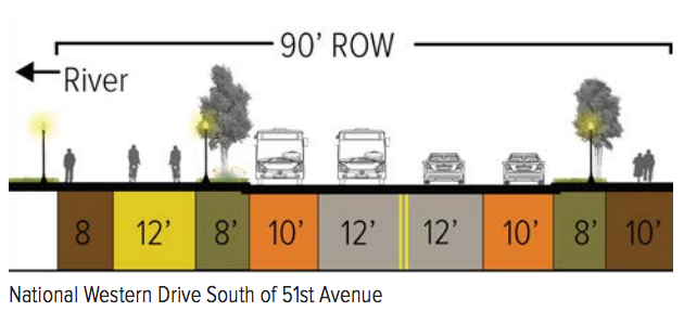
National Western Drive: The current street of the same name will move west to improve access to the South Platte River Trail. It will remain two lanes wide, and will get a two-way raised bike lane on one side.
But again, travel lanes for cars and trucks will be too wide, which is curious given that the plan says “traffic calming will need to be incorporated into the final design” for this street.
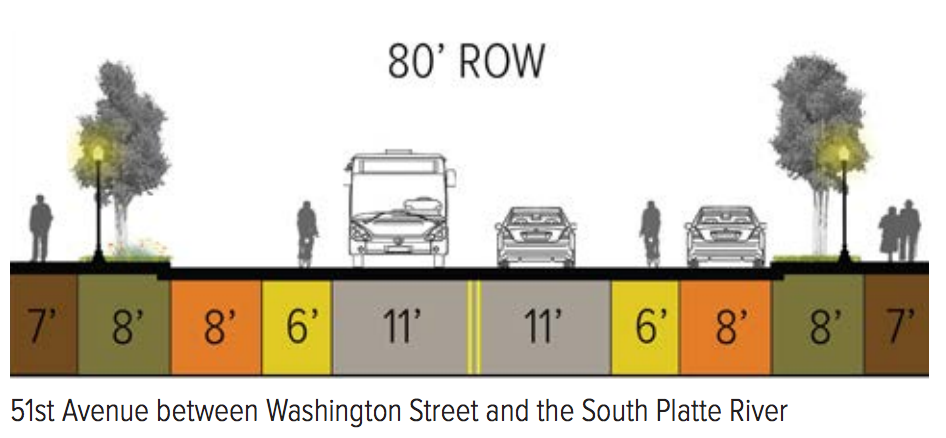
51st Avenue: 51st Avenue will be extended to cross the river and connect Washington Street with National Western Drive. The street will include bike lanes and connect to an elevated structure solely for people walking and biking to and from the future National Western RTD station. Planners are going for a “High Line-like experience.”
Other new walking and biking routes: A new ped/bike path would connect Colorado Commons to Globeville Landing Park and the South Platte River Trail along the west side of the Denver Coliseum site. Race Court would also get new bike lanes.

Transit: Planners want to build a circulator bus route for the campus to help people get around without a car, which is good for people who already at National Western Center. But making buses more frequent along Washington Street, Lincoln Street, Brighton Boulevard, and 47th Avenue would go a lot further in decreasing the parking “need” that planners say is necessary.